


GLACIATION PROCESSES AND FEATURES
-
Explain the theories which aspire to explain the occurrence of glaciers in various parts of the world
Several scientific theories attempt to explain the distribution and formation of glaciers worldwide:
1. Astronomical Theory (Milankovitch Cycles)
- Eccentricity: Changes in Earth's orbital shape (100,000-year cycle)
- Obliquity: Variations in axial tilt (41,000-year cycle)
- Precession: Wobble in Earth's rotation (26,000-year cycle)
- Impact: Affects solar radiation distribution and intensity
2. Plate Tectonics Theory
- Continental drift positions landmasses at high latitudes
- Mountain building creates high-altitude snow accumulation zones
- Ocean current changes affect heat distribution
- Example: Antarctic glaciation began when continent moved over South Pole
3. Atmospheric Composition Theory
- Greenhouse gas variations (CO₂, methane) affect global temperatures
- Volcanic activity can trigger cooling via aerosol emissions
- Industrial revolution impacts on modern glaciers
4. Albedo Feedback Theory
- Ice-snow reflectivity increases as glaciers expand
- Positive feedback loop accelerates cooling
- Explains rapid glacial advances during ice ages
[Diagram showing Milankovitch cycles and their impact on glaciation]Current consensus: Most scientists believe glacial periods result from complex interactions between astronomical factors, atmospheric composition, and Earth's geography.
-
Explain the features due to glacier erosion in highland (Alpine) areas
Alpine glaciers create distinctive erosional landforms through plucking and abrasion:
Valley Features:
- U-shaped valleys: Steep-sided, flat-bottomed valleys carved by glacier movement
[Cross-section comparing V-shaped river valley to U-shaped glacial valley]
- Hanging valleys: Tributary glaciers left elevated above main valley
Create spectacular waterfalls like Yosemite Falls
- Cirques: Bowl-shaped depressions at glacier origins
- Arêtes: Sharp ridges between adjacent cirques
- Horns: Pyramid-shaped peaks formed by multiple cirques (e.g., Matterhorn)
Rock Features:
- Roche moutonnée: Asymmetrical rock hills with smooth up-ice and jagged down-ice sides
- Striations: Parallel scratches on bedrock from embedded rocks in glacier base
- Glacial polish: Smooth rock surfaces created by fine abrasion
- Truncated spurs: Cliff-like ends of ridges cut off by glacier movement
Feature Formation Process Example Locations Fjords Glaciated valleys flooded by sea Norway, New Zealand Tarns Lakes in cirque basins Alps, Rocky Mountains Cols Passes between adjacent cirques Mountain ranges worldwide - U-shaped valleys: Steep-sided, flat-bottomed valleys carved by glacier movement
-
How useful are glacial erosional and depositional features to human beings
Benefits of Glacial Erosional Features:
- Tourism: Spectacular landscapes attract visitors (e.g., Yosemite, fjords)
- Water storage: Cirque lakes and U-shaped valleys form natural reservoirs
- Fertile soils: Ground rock flour enriches agricultural land
- Transportation: Glacial valleys provide natural routeways
- Hydropower: Steep valleys ideal for dam construction
Benefits of Glacial Depositional Features:
- Agriculture: Till plains provide fertile soils (e.g., American Midwest)
- Construction materials: Sand and gravel from outwash plains
- Groundwater reservoirs: Porous glacial deposits store water
- Mineral deposits: Placer deposits in glacial sediments
- Landform diversity: Creates varied habitats for ecosystems
Feature Human Use Economic Value Moraines Soil fertility, landscaping High agricultural value Eskers Road foundations, aggregate Construction industry Kettle lakes Recreation, fisheries Tourism revenue Cultural significance: Many glacial landscapes hold spiritual and historical importance for indigenous peoples worldwide.
-
Discuss the features due to glacial deposit
Glaciers deposit various landforms as they melt, classified by deposition method:
Direct Glacial Deposits (Till):
- Moraines: Ridges of unsorted glacial debris
[Diagram showing different moraine types in a glacial valley]
- Drumlins: Streamlined hills of compacted till
- Erratics: Large boulders transported far from source
- Till plains: Extensive flat areas of glacial deposits
Meltwater Deposits (Stratified Drift):
- Outwash plains: Sandur deposits beyond glacier terminus
- Eskers: Winding ridges of sorted sediment from subglacial streams
- Kames: Steep-sided mounds of stratified drift
- Kettle lakes: Depressions from buried ice blocks melting
- Varves: Annual layers in glacial lake sediments
Deposit Type Sorting Typical Composition Till Unsorted All particle sizes mixed Stratified drift Sorted Layered by size Scientific value: Glacial deposits provide records of past climate conditions and ice movement directions.
- Moraines: Ridges of unsorted glacial debris
-
What negative effects does glaciation have on Earth
Ecological Impacts:
- Habitat destruction: Crushing of ecosystems under ice sheets
- Species displacement: Forced migration of flora and fauna
- Sea level changes: Coastal flooding or exposure during cycles
Geological Hazards:
- Glacial outburst floods: Sudden release of meltwater (jökulhlaups)
- Isostatic rebound: Earth's crust rising after ice melt causes earthquakes
- Permafrost melting: Releases greenhouse gases and destabilizes land
Human Impacts:
- Landscape alteration: Destruction of pre-glacial landforms
- Resource limitations: Ice cover makes mineral extraction difficult
- Infrastructure damage: Glacial movement destroys human constructions
- Modern concerns: Retreating glaciers threaten water supplies
[Diagram showing impacts of glacial retreat on sea levels and ecosystems]Long-term effects: Past glaciations have permanently altered global drainage patterns and continental configurations.
-
Classify moraines
Moraines are classified by their position relative to the glacier:
Moraine Type Location Characteristics Lateral Along glacier sides Ridges parallel to flow direction Medial Between glacier tributaries Formed by merging lateral moraines Terminal At glacier terminus Marks maximum advance position Recessional Behind terminal moraine Marks temporary standstill positions Ground Beneath glacier Irregular blanket of till Push At glacier front Material bulldozed during advance [Diagram showing moraine types in relation to glacier position]Special types: Washboard moraines (small parallel ridges) and hummocky moraines (irregular mounds) form under specific glacial conditions.
-
Glacial regions are not necessarily bad - discuss
Ecological Benefits:
- Freshwater storage: Glaciers are Earth's largest freshwater reservoirs
- Unique ecosystems: Support specialized flora and fauna
- Climate regulation: Reflect solar radiation and influence ocean currents
Human Benefits:
- Water supply: Seasonal melt provides water for billions
- Renewable energy: Glacial rivers feed hydroelectric projects
- Scientific value: Ice cores preserve climate records
- Economic resources: Mineral deposits and fertile soils
- Tourism: Glacier tourism supports local economies
Geological Benefits:
- Landscape diversity: Create varied topography
- Soil formation: Ground rock produces fertile till
- Resource concentration: Deposits valuable minerals
Balanced view: While glaciation presents challenges, it also provides essential ecosystem services and resources that benefit both nature and human societies.
-
Contrast the effects of glaciation on highland and lowland areas
Aspect Highland Areas Lowland Areas Dominant Process Erosion predominates Deposition predominates Landforms Created Cirques, arêtes, horns, U-shaped valleys Till plains, drumlins, eskers, moraines Glacier Type Alpine/valley glaciers Ice sheets/continental glaciers Movement Channeled by topography Unconstrained radial flow Erosional Features Deep valleys, truncated spurs Scoured bedrock, roche moutonnée Depositional Features Lateral/medial moraines Terminal moraines, outwash plains Human Impact Creates dramatic scenery Forms fertile agricultural lands [Diagram comparing highland and lowland glacial impacts]Key difference: Highland glaciation is primarily erosional, creating dramatic relief, while lowland glaciation is primarily depositional, smoothing and covering the landscape.
-
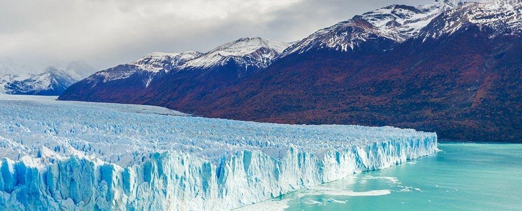
Explain the types of glaciers
Glaciers are classified based on their size, shape, and location:
Glacier Type Description Examples Ice sheets Massive continental-scale glaciers (>50,000 km²) Antarctica, Greenland Ice caps Smaller versions of ice sheets (<50,000 km²) Vatnajökull (Iceland) Valley glaciers Confined to mountain valleys Mer de Glace (France) Piedmont glaciers Spread out at mountain bases Malaspina (Alaska) Cirque glaciers Small glaciers confined to bowl-shaped depressions Common in Rockies, Alps Tidewater glaciers Terminate in ocean water Hubbard Glacier (Alaska) Ice shelves Floating extensions of ice sheets Ross Ice Shelf Special Glacier Types:
- Rock glaciers: Ice-cemented rubble that flows slowly
- Hanging glaciers: Cling to steep mountain slopes
- Reconstituted glaciers: Form from ice avalanches
- Ice fields: Extensive areas of interconnected glaciers
[Diagram showing different glacier types and their locations]Current changes: Many glacier types are retreating rapidly due to climate change, with significant impacts on water resources and sea levels.

No comments
Post a Comment